|
Maltese Cartography |
||
|
No title.
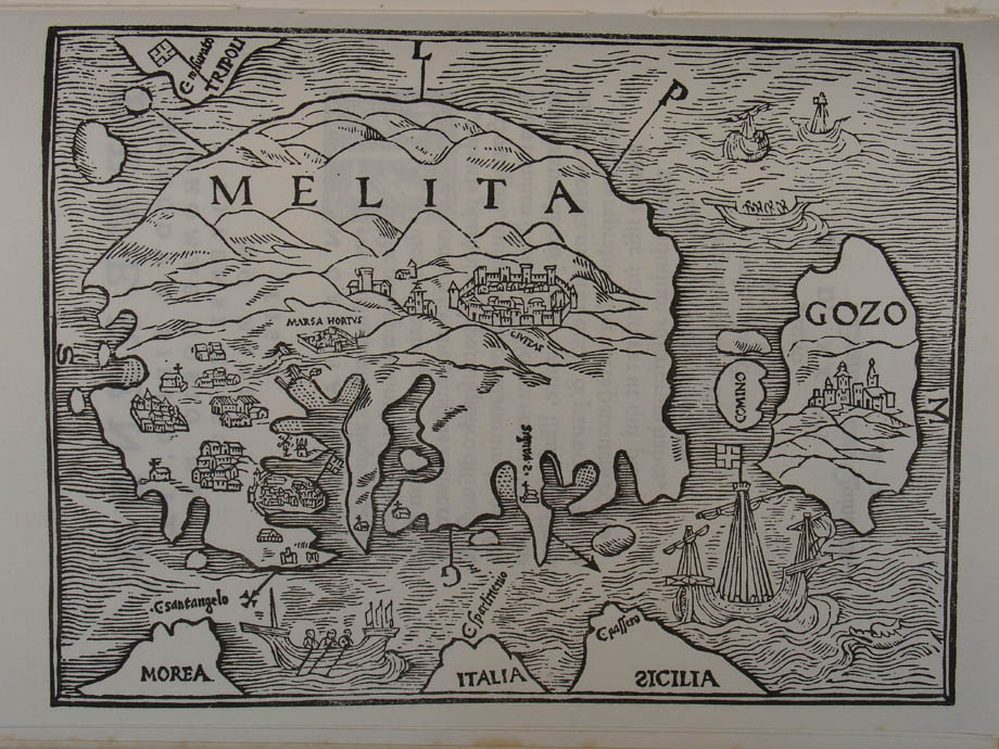
Lyons (?) 1536. Woodcut 187 x 137 Scale c 1:230,000 South West at the top The Maltese archipelago with out of scale
parts of The first printed map of Quintin, a French Knight, came to |
||
|
|
||
|
Petri, Henricus, cartographer and engraver Melita. 1561. 80 x 120 Scale c 1:385,714 Petri’s woodcut is undoubtedly influenced by
the round shaped form of Quintinus’s |
||
|
|
||

|
Zenoi, Domenico, cartographer, engraver and
publisher Assedio de l’ Isola di Malta 1565. 204 x 150 Scale c 1:190,000 South West at the top Bird’s-eye view of events for the Great
Siege of Malta (1565). The map was engraved on copper and published
in the Paolo Forlani and Domenico Zenoi town books ( The delicate Zenoi engraving was included by
Zaltieri in his Disegni delle piu` Illustri Citta` et Fortezze del Mondo. |
||
|
|
||

|
Perez d’ Aleccio, Matteo, engraver Disegno dell’ Isola di Malta et La Venuta
dell’ Armata Turchesca a Di XVIII di Maggio MDLXVI. 430 x 340 Scale c 1:70,000 South West at the top Reprint of Perez d’ Aleccio’s engraving of
the Great Siege of Malta in 1565, originally published in an album of etchings
(1582) which in turn reproduced the artist’s frescoes of the Siege in the Grand
Master’s Palace, Valletta. Displeased at the dedication to Cardinal dei Medici, Grand Master
Verdale withdrew his favour and ensured that few copies were published. D’ Aleccio’s work was reprinted in 1631 by
Antonio Francesco Lucini of |
||
|
|
||

|
Villamena, Francesco, engraver 434 x 325 Scale c 1:4,000 Inset of Maltese archipelago.
Compass rose with inset of From the third volume of Istoria della Sacra Religione di S. Giovanni Gerosolmitano by Giacomo Bosio, Roma, 1594 – 1602. |
||
|
Anon Isole di Malta e del
Gozo. Malta
(?) 1647. 385 x 174 Scale c 1:125,000 South East at the top Cartouche with quotation from the Book of
Isaiah: In Insulis Maris Nomen Dni Dei Israel Folding map in Gio Francesco Abela’s Della
Descrittione di Malta. Crudely engraved map with letterpress title and key to 130 features. The Chersonesos or peninsula overlooking the Malta-Gozo straits is a direct reference to the much debated site referred to by the early geographers Ptolemy and Cluverius. |
||
|
|
||

|
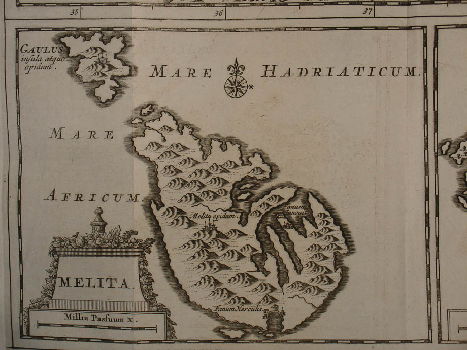
Cluverius, Philip,
cartographer Melita. Wolfenbuttel, c 1659. 170 x 130 Scale c 1:321,800 Small map of The map identifies the classical sites of the ancient capital Melita and the temples of Juno and Hercules. |
||
|
|
||
|
Anon Veteris Melitae Urbis Typus.
Malta (?) 1647 238 x 178 Scale c 1:2,500 West at the top Bird’s eye view with key. A
crude engraving (possibly on brass) of Mdina as it might have appeared in Roman
antiquity. Short key in letterpress to
the left of the plate. In Gio. Francesco
Abela Della Descrittione di Malta.
|
||
|
Aubry, Abraham, engraver No title.
Helmstedt c. 1658. 95 x 70 Scale c 1:570,000 South West at the top Small map of the Maltese archipelago within
a scroll border at the foot of the engraved title page of An accomplished engraving by Aubry of
Strasbourg. The smallest recorded map of the archipelago. |
||
|
|
||

|
Blaeu, Joan, cartographer and engraver Melita Insula vulgo Malta. 560 x 444 Scale c 1:90,000 West at the top Title cartouche flanked by a Knight of the
Order and a Turkish soldier, with swords drawn; and the Holy Trinity with
Saints. Maltese archipelago, showing naval battle between
the Order and the Turks. An artistically
very well-balanced map from the leading firm of Dutch map engravers of the 17th
century. This map, and a Blaeu plan of |
||
|
|
||

|
Blaeu, Joan, engraver Valletta Citta` et Fortezza nell’ Isola di
Malta. 508 x 404 Scale c 1:3,750 South East at the top |
||
|
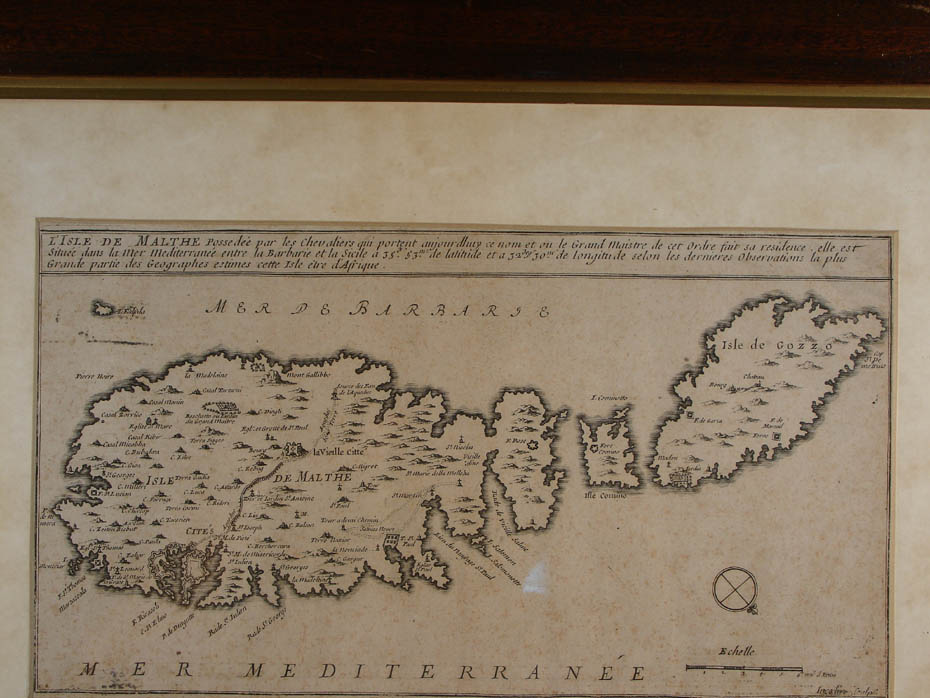
De Fer, Nicolas, cartographer Inserlin, Charles, engraver L’Isle de Malthe. 287 x 155 Scale c 1:165,000 South West at the top Probably from de Fer’s Les Forces de l’ ‘La plus grande partie des geographes
estimes cette Note the acqueduct and the two Naxxar – Mellieħa roadways. |
||
|
|
||
|
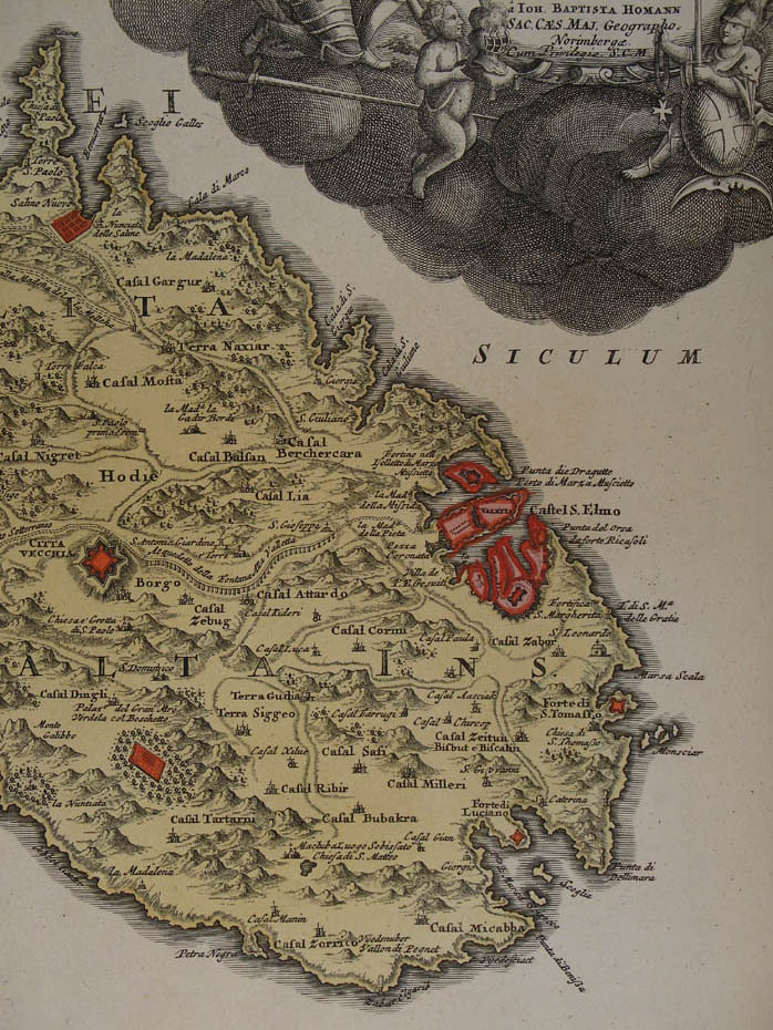
Homann, Johann Baptist, cartographer,
engraver and publisher Insularum Maltae et Gozae quae sunt Equitum
S. Ioannis Hierosolomitani Ordinis Melit. Sedes Principalis. 576 x 483 Scale c 1:85,000 The Maltese archipelago with
inset view of Elaborate cartouches around scale, inset,
and title. This is the first of the highly decorative
18th century maps of |
||
|
|
||
|
De Berey, Charles Amadeus (II), engraver Le Villes, Forts et Chateaux de Malte 1724. Paris (?) 1724. 340 x 223 Scale c 1:15,500 South West at the top An accurate plan of |
||
|
De Berey, Charles Amadeus, engraver Batteries et Des Redoutes Faites pour la
Deffence de la Coste. Paris (?) 1726. 340 x 223 Scale c 1:100,000 South West at the top Drapery title cartouche Map of the archipelago drawn to show the coastal defences of the Order
in Folding map in a reprint edition of l’ Abbe
Rene’ Aubert de Vertot’s Historie des Chevaliers Hospitaliers de St. Jean de
Jerusalem. |
||
|
Sanson, Nicolas, cartographer Winter, De Eilanden van Malta – Goza. Early
18th century. 307 x 204 Scale c 1:178,800 |
||
|
|
||

|
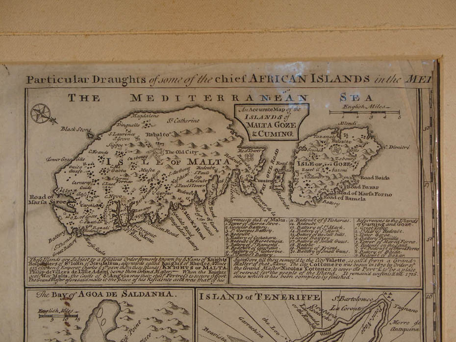
Bowen, Emmanuel, cartographer and publisher Particular Draughts of some of the 210 x 105 Scale c 1:250,000 South West at the top Engraving from A Complete Atlas or
Distinct View of the Known World. Note the numbered sites for the
fortifications of |
||
|
|
||
|
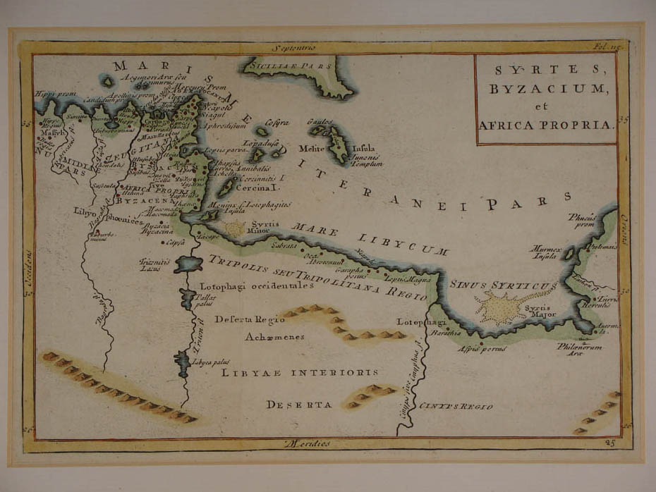
Anon Syrtes, Byzacium, et 208 x 140 Scale c 1:10,000,000 Folding map showing the classical sites of
Southern Sicily, and the North African coast with Fine hand colouring. |
||
|
|
||
|
Anon Carte de l’Isle de Malte. 165 x 215 Scale c 1:135,000 South West at the top Map of |
||
|
|
||

|
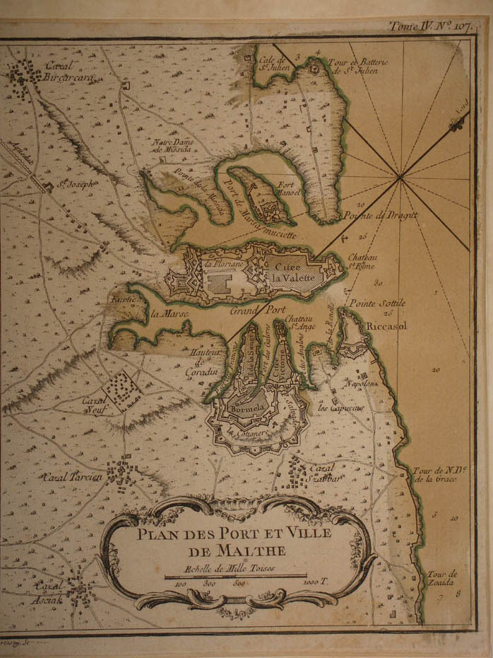
Anon Plan des Port et Ville
de Malthe. 177 x 219 Scale c 1:38,100 North East at the top The Grand and Marsamxett harbour with |
||
|
|
||
|
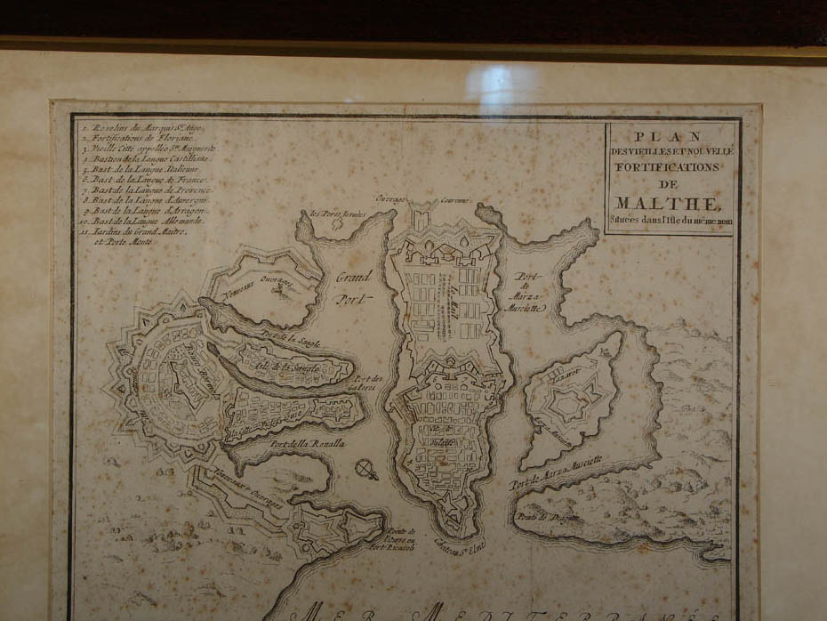
Anon Plan de Vieilles et Novelle Fortifications
de Malthe situees dans l’ Isle du Meme Nom. Paris (?)
mid-18th century. 275 x 213 Scale c 1:20,000 South West at the top |
||
|
|
||
|
Sesone, Francesco La Citta della Valletta nell’ Isola di Malta. 160 x 101 Scale c 1:10,000 South East at the top Birds-eye view of |
||
|
Anon 710 x 295 Scale c 1:65,000 South West at the top Anonymous engraving lacking in chiaroscuro,
with two florid cartouches. Folding map
in Abela, Gio Francesco & Ciantar, Gio Antonio Malta Illustrata. |
||
|
|
||

|
Anon L’ Antica Citta di Malta Oggi detta Notabile Ristretta e Cinta di Mura. 185 x 293 including key Scale c 1:4,000 Large baroque cartouche with arms of Vittoriosa, |
||
|
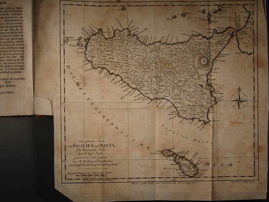
Kitchin, Thomas, cartographer Dorn, Sebastian, engraver Eine genave Charte von
Sicilien und Malta für Brydön’s Reise durch diese Inseln. 290 x 263 Scale c 1:1,330,000 Map in a 1777 Liepzig edition of Patrick
Brydone’s A Tour Through Sicily and Malta. |
||
|
|
||
|
Borch, le Comte de, artist Pittarelli, Joseph, engraver Les Freres Reycends, publisher Carte de la Sicilie Moderne Fait d’Après de
Nouvelles Observations en 1778. 411 x 395 Scale c 1:675,000 Cartouche of monumental stone, surrounded by
yucca and cacti. Folding map in Le Comte de Borsch’s Lettres
sur le Sicile et sur l’Ile de Malthe.
|
||
|
|
||

|
Ittar, Sebastiano, engraver No title.
237 x 100 Scale 1:190,000 South West at the top. Compass star incorporating the St. John
Cross. Folding map of the Maltese archipelago in Malte
Par Un Voyageur Francais by E. de Guignard Comte de Saint Priest. Ittar’s map identifies the ruins of the |
||
|
|
||

|
Capitaine, Louis, engraver Carte des Isles de Malte et du Goze Conquise
par l’ Armee Navale de la Republique Francaise Commandeé par le General
Buonaparte. 735 x 223 Scale c 1:85,000 South West at the top Folding map in Recherches Historiques et
Politiques su Malte. Dedicated to the French Directory on the
occasion of Napoleon’s capture of |
||
|
|
||

|
Boisgelin de
Kerdu,
Louis de, cartographer Neele, Samuel John, engraver A New Sea & Land Chart of the Sovereign
Principality of 1290 x 551 Scale c 1:38,000 North East at the top Cartouche depicting Knight of the Order
attempting to reach one of the Order’s vessels floundering off Topography of the Maltese archipelago. A good example of English mapping of the
early nineteenth century. The hatching
used to depict hills and valleys is similar to that used on early Ordnance
Survey maps. The chart was planned
‘under’ the ‘ particular inspection’ of Chevalier de Boisgelin for his Ancient
and Modern Malta. |
||
|
Neele, Samuel John, engraver Map of Sicily & C. 254 x 201 Scale c 1:804,600 Map of |
||
|
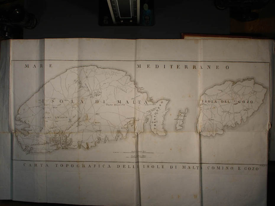
Ruga, P, engraver Carta Topographica delle Isole di 566 x 219 Scale c 1:87,719 South West at the top Folding map of the Maltese archipelago in Malta
Antica Illustrata co` Monumenti, e coll` Istoria by Comm. Onorato Bres. |
||
|
|
||
|
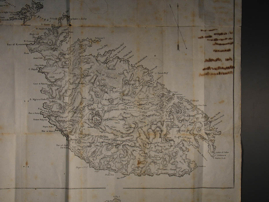
Brocktorff, Luigi Map of Lithograph 458 x 340 Scale c 1:95,000 Maltese archipelago with inset offshore view
of Folding map in the first edition of George
Percy Badger’s Description of Malta and Gozo. This detailed map identifies, among others, all the Order’s fortifications and shore entrenchments. The area Paola – Cottonera is described as deserted while the San Giuseppe cluster of houses on the aqueduct route marks the site of present day Ħamrun. |
||
|
|
||
|
Duvotenay, Theodore, cartographer Lemaitre, Augustin Francois, engraver Iles de Malte et du
Gozo. 108 x 170 Scale c 1:293,400 Frederic Lacroix’s L’ Univers: Histoire
et Description de Tous les Peuples. Iles
de l’ Afrique: Malte et le Goze. |
||
|
|
||

|
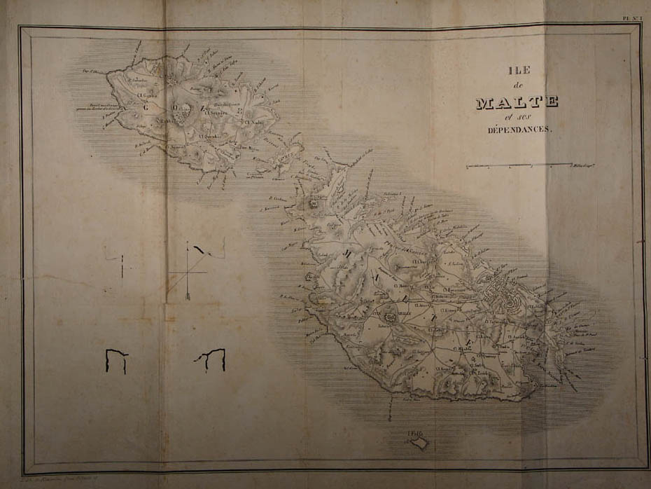
Koeppelin, Georges de, engraver Ile de Malte et Ses Dependances. 375 x 267 Scale c 1:95,000 Folding map of |
||
|
|
||
|
Anon No title.
19th century. 175 x 130 Scale c 1:230,000 South West at the top Hydrographic map of Maltese anchorages |
||
|
|
||

|
Stanford Geographical Establishment 196 x 146 Scale c 1: 215,424 Folding map in Guide to the |
||
|
|
||

The End