

Understanding how the landscape influences human movement is central to many fields of scientific inquiry, encompassing:
- the study of travel corridors
- dispersal rate
- archaeological site location
- maritime pathways
- animal seascape connectivity
- pastoral foraging routes
- off-road transportation
- maritime search and
- rescue operations.
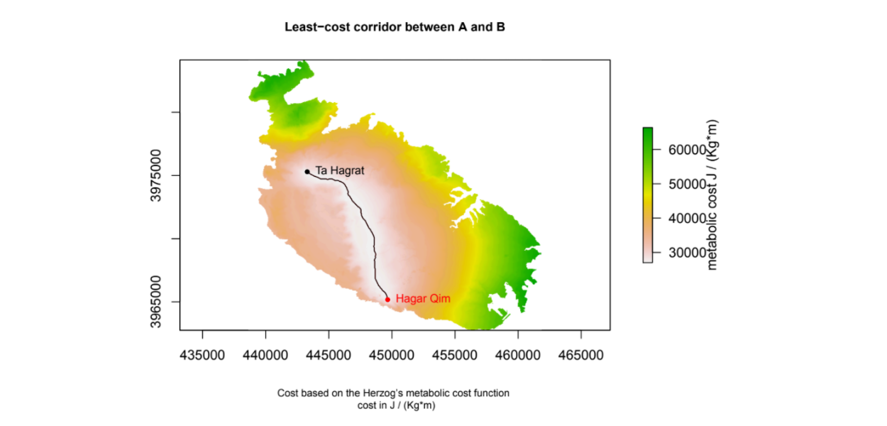
Dr Gianmarco Alberti, resident academic lecturer at the Department of Criminology, has authored a software (named movecost) for the calculation of least-cost paths and corridors related to human movement across the landscape, considering the terrain slope as a major factor influencing the easiness of movement. The software has been developed under the R statistical programming language and is freely accessible from the official repository of R packages. It estimates the cost of human movement in terms of time and/or energetic expenditure, and returns nicely formatted maps.
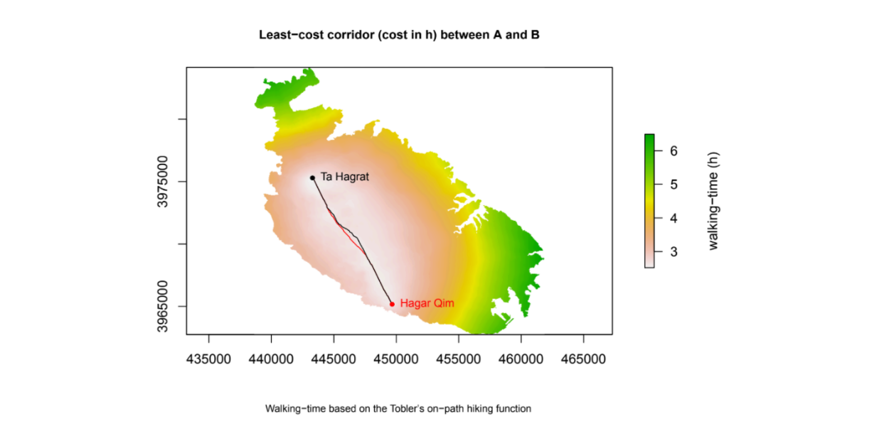
The provided images show the least-cost corridor between two cultural heritage sites in Malta, namely Ħaġar Qim and Ta' Ħaġrat. In figure 1, the cost is expressed in terms of walking time (hours), while in the second it is conceptualized in terms of energetic expenditure. In both images, the lighter the colour, the smaller is the cost incurred when moving between the two locations. The part of the intervening landscape where the cost of moving is the least becomes apparent.
With a growing trend of daily downloads, the software is being increasingly used. As of April 2021, scholars world-wide have employed it to address research questions related to conservational priorities in tropical biodiversity, human movement and gully erosion, forest management, domestication and herding, conservation status of dolphins, land use and landscape dynamics (source: Google Scholars).


