
In an attempt to assess potential tsunami hazards around the Maltese Islands and improve tsunami resilience, a recent collaborative study was conducted between the Marine Geology and Seafloor Surveying group within the Department of Geosciences at the University of Malta, and scientists from GNS Science in New Zealand.
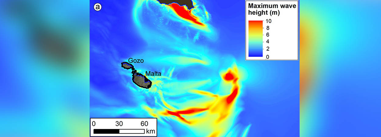
These potential hazards were quantified through four computer simulations, which included two submarine earthquakes offshore of Sicily and Greece, and two submarine landslides offshore of Malta and Sicily.
The study found that the simulated extent of tsunami inundation was highest along the eastern coastline of the Maltese Islands for submarine landslide sources. Tsunamis triggered by submarine landslides of the size considered in this study are rare and estimated to occur once in 5,000 to 50,000 years.
“Our study demonstrates that there is a potential tsunami hazard for Malta. Future studies should focus on achieving a better understanding of the source mechanisms, for example by mapping and understanding submarine landslides around the Maltese Islands, and carrying out a probabilistic inundation hazard and risk assessment,” the scientists concluded.
More details can be found in the article authored by Christof Mueller, Aaron Micallef, Daniele Spatola and Xiaoming Wang, which was recently published in the scientific journal Pure and Applied Geophysics.


