
GLIDER SOUTH is another major physical oceanography research initiative making use of state-of-the-art data acquisition platforms to study the sea. The initiative is led by the University of Malta’s Physical Oceanography Research Group (PO-Res. Grp) in collaboration with CNRS-INSU (Centre National de la Recherche Scientifique – Institut National des Sciences de l’Univers). This project is coordinated by Prof. Aldo Drago (aldo.drago@um.edu.mt).
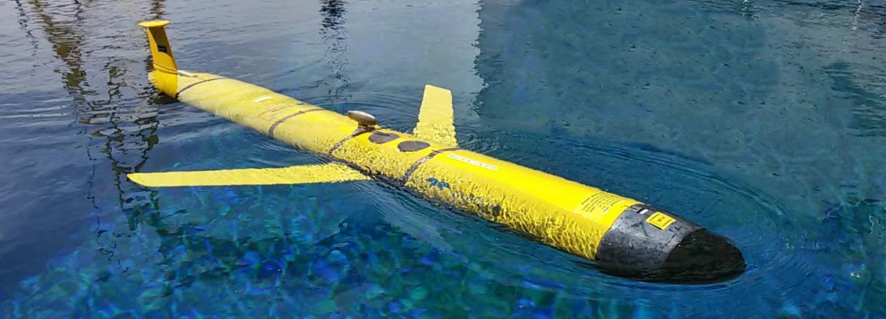
Underwater gliders are autonomous torpedo-like vehicles which have the ability to dive up and down repeatedly in the sea to a depth of 1000m, moving along paths with remote control from a land based station. They can be used to collect physical and biogeochemical data relevant to the state of health of the sea, at high spatial resolution, for long periods of time, even under adverse meteorological conditions. The glider communicates with a land station by satellite links every time it surfaces, relaying collected data and receiving instructions remotely for the next dive.
The sea glider was deployed close to Malta two months ago. It has since then performed transects between the Maltese Islands and the southern Mediterranean shelf. This area of the Mediterranean Sea is comparatively unexplored. Hydrographic data in this region is very scarce and the project provides pristine data which will help to understand the dynamic phenomena observed in the stretch of sea between Malta and Libya. Furthermore, data collected will be used to validate oceanographic models of the area. The PO-Res. Grp is the lead partner in this project, which will further put our marine research capacity on the map as a key contributor in operational oceanography and physical oceanographic endeavours in the Central Mediterranean area.
The Armed Forces of Malta supported the GLIDER South entire mission with boats and crew. For the deployment operation a RHIB launched from the maritime patrol boat was used to slide down the glider into the sea. AFM also assisted to launch a number of drifters that wefre concurrently used to track sea currents in the area.
This project is supported by the European Commission – H2020 Framework Programme, JERICO NEXT under grant agreement No. 654410.
The sea glider was further employed along a track close to the Maltese Islands to demonstrate how adaptive monitoring strategies using remotely controlled unmanned devices provide cost effective methods to routinely collect basic marine data and measure the health of our coastal waters.
A half-day seminar on 7 July 2017, at 08:45, at the Dolmen Resort Hotel, Qawra, will present the sea glider experience in Malta to key stakeholders and interested parties, and will showcase how the new generation of sea gliders offers an innovative aid to observe and monitor the sea areas under local jurisdiction. With the participation of local scientists and two foreign experts, the seminar provides an avenue to brainstorm the way to the shaping of the operational marine observing system for the Maltese Islands.


