
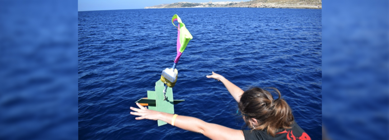
Students in action deploying sea drogues for tracking surface currents
Students following the M.Sc. course in Applied Oceanography have just completed the fieldwork activity that comprises one of the study units of the course. The activity was conducted during a one-week live-in experience planned and supervised by academic staff of the Physical Oceanography Research Group (Dept. of Geosciences). The students were introduced to the baseline principles comprising the planning and execution of oceanographic field studies, with hands-on experience in scientific data acquisition in the marine environment, direct use of marine equipment, instrument calibration and deployment, data extraction and processing. The work featured fieldwork, lab work, lectures, joint analysis of data, group discussions and scientific evaluations.
This year the marine domain of study was the North Comino Channel, the small stretch of sea between the islands of Gozo and Comino, being one of the two relatively narrow passages that allow exchange of water masses between the eastern and western coastal sea areas of the Maltese Islands. The Channel is a relatively unexplored area which is known to be a highly-flushed water body with reversible currents of substantial strength following barotropic and baroclinic gradients forcing the flow.
The profiling of underwater temperature at a selected station with 35 m depth was made by means of a string of temperature loggers at discrete depths. A sea current meter was deployed at the station to measure currents, temperature and salinity close to the seabed. The instruments were set to investigate the variability of the physical parameters at high temporal resolution. A YSI CTD was deployed at several stations to profile water temperature, conductivity, pH and dissolved oxygen. Surface currents were measured by means of drogues carrying GPS trackers and lagrangian CODE coastal drifters which were followed by satellite tracking. Water quality was assessed at three stations across the Channel by means of Secchi disk (to measure the water turbidity) and Niskin bottle water sampling at selected depths and lab analysis of filtered samples for chlorophyll concentration by spectrophotometry. An underwater camera was used for benthic mapping along transects following chosen isobaths. A number of benthic sediment samples were collected off Ħondoq ir-Rummien by means of hand-held corers deployed during SCUBA dives. Posidonia shots from the samples were used to assess the health of sea grass in the area using the Posidonia Rapid Easy Index (PREI). Granulometric analyses of the dried sediment samples was correlated to the dynamical regimes. All these measurements were used by students to assess how the marine biota and habitats are influenced by the site-specific dynamics. The study served to better understand the dynamics in this highly-flushed channel and to characterise the benthic and pelagic baseline ahead of putative environmental impacts that planned developments may have on the contiguous marine area.
Under the coordination of Prof. Aldo Drago, the PO Res-Grp. availed of three other academic members (Prof. Alan Deidun, Dr Adam Gauci and Dr Anthony Galea) as well as dedicated technical and administrative staff members (Ms Raisa Tarasova, Mrs Audrey Zammit and Mrs Tiziana Bartolo) to conduct this effort. Mr. John Spiteri from the Chemistry Department assisted in the water quality measurements.
Do you have what it takes to enlist and join next year’s boot camp?
Log on and find out more online.
The online application form can be accessed via: www.um.edu.mt/apply


