
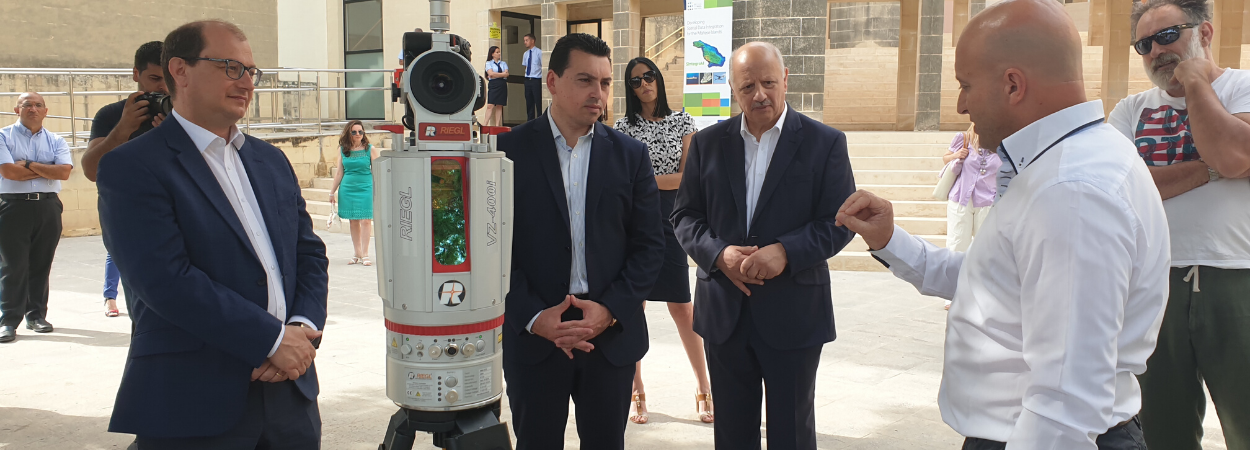
The purchase of new technological equipment has enabled the progression of SIntegraM, a €7 million project seeking to develop and implement a national spatial data infrastructure to a more advanced stage.
Spatial data represents location, size and shape of an object. The use of this new technology will upgrade Malta’s spatial data capacity and help reduce Malta’s reliance on foreign entities through the exchange of data and cost-sharing across government entities.
In other words, the SIntegraM project brings together inter-entity collaboration with the aim of removing information redundancy locally, and preparing Malta for a common spatial dataset that will be used by all, whether for sea-level rise analysis, water consumption, flora and fauna protection, quarry stock volumes, crime scene analysis, or traffic movements.
The complete set of technologies powering the project include terrestrial scanners (laser scanners and land surveying equipment), mobile scanners (fully-equipped urban and rural scanning van), aerial drones (Unmanned Aerial Vehicles), marine scanners (Underwater Autonomous Vehicle), handheld scanners and a CAVE.
During a visit to the Immersion Labs at the University of Malta, which is where some of this equipment is housed, UM Rector Prof. Alfred J. Vella highlighted the cross-Faculty collaboration that this project brought together. The years dedicated to conceptualising, researching and creating strategies has in fact enabled the synergising of many disciplines, ranging from criminology, earth sciences, psychology and social work, Archaeology, marine research, social wellbeing, built environment, art, gaming, ICT and so on.
Minister for the Environment, Climate Change and Planning, Hon. Aaron Farrugia, and Parliamentary Secretary for European Funds, Hon. Stefan Zrinzo Azzopardi, who were both present for this visit, agreed that the rolling out of this project was of significant importance to arriving towards evidence-based policy making.
The next years will be dedicated to capturing the environment parameters such as street façade scanning, combining different datasets, creating information and then depicting it in a virtual environment for scenario analysis.
“Since the launch of the CloudIsle Initiative that depicted the first 3D map of the Maltese Islands in 2017, technologies have advanced drastically, and the University has been instrumental in ensuring that this project has tangible goods for society. Through insight and inter-entity collaboration, we have pushed for foresight, and then pushed the envelope for social wellbeing”, said Prof. Saviour Formosa, who conceptualised and drove the SIntegraM project.
The project was managed by the Planning Authority as Project Leader as led by Ms Ashley Hili. The 40+ partners from the different Ministries participated in the diverse deliverables. PA Executive Chairman, Mr Martin Saliba, welcomed the role that the Planning Authority took in its flagship task in enhancing the Spatial Data Infrastructure of the Maltese Islands and the subsequent impact on academia and social wellbeing.
More information on this project can be found through this link.


