
The Seismic Monitoring and Research Group in the Department of Geosciences, has recently been awarded a €120,000 grant in the Energy and Water Agency R&I Project Support Scheme to carry out an innovative research project called SIGMA – Seismic Imaging of Groundwater for Maltese Aquifers.
The project, which will run for 2 years, will use a novel approach towards imaging the spatial and temporal characteristics of our aquifers.
Seismic ambient noise is made up of continuous vibrations of the ground surface and shallow rock layers due to natural and anthropogenic sources such as wind, waves and traffic. These vibrations move in all directions as surface wave-trains, whose speed depends on the properties of the rocks through which they pass, including water content.
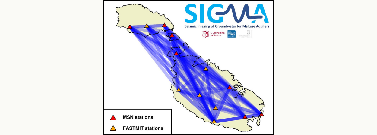
A large data set of such noise is available on stations of the Malta Seismic Network and other temporary instruments, spanning the whole archipelago. The project will use signal processing techniques on this data, mainly cross-correlation of noise between pairs of stations, to extract information about the subsurface, and track temporal and spatial changes in water content at different scales.
These changes will be related to in situ borehole readings and meteorological parameters, thus hoping to validate the method as an additional tool for groundwater management. The proposed technique will provide subsurface imaging with much wider coverage than single-point boreholes, as it links all possible station pairs. It is also cost-effective, since it utilises an ever-present source, and environmentally friendly, being completely non-invasive.
SIGMA will soon offer a funded scholarship for a prospective Master student. Students interested in Earth sciences and proficient with computer programming are invited to contact Dr. Sebastiano D'Amico and Prof. Pauline Galea.
For more information visit the project website.
Project SIGMA is financed by the Energy and Water Agency under the National Strategy for Research and Innovation in Energy and Water (2021-2030).


